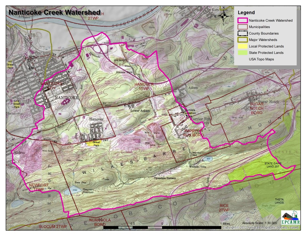
Nanticoke Creek is approximately 20 miles long, originating at the Hanover Reservoir and near Witinski Villa along Wilkes-Barre Mountain in Hanover Township and discharging into the North Branch of the Susquehanna River in Nanticoke City. Nanticoke Creek is located in the southeastern portion of Wyoming Valley and is contained within four (4) municipalities. The Nanticoke Creek Watershed is comprised of three (3) individual sub-watersheds including Leuders Creek, and Espy Run.
A majority of the watershed is underlain by underground mines, to which it loses surface water flows to the mine pool. There is evidence of stream rerouting, specifically in the Espy Run subwatershed, where the headwater section coming from Espy Gap has been severed from the lower section of Espy Run around the Rhone Section of Hanover Township (the Earth Conservancy addressed this issue with their Bliss Banks Project). The headwaters section of Espy Run is routed northeast to Leuders Creek (which is not named properly on USGS maps). The creek picks up two AMD deep mine discharges: the Truesdale Shaft near Askam and the Espy Run Seeps near Loomis Park.
The video below shows the Askam Treatment System constructed in 2014 along Dundee Road after the Truesdale Shaft and Borehole collapsed in 2009 leaving the old Dundee Wetlands AMD Treatment System high and dry and flooding out local residents up to 3/4 mile away. New boreholes were drilled in a more stable location across the road from the old treatment system and directly into Nanticoke Creek. This new treatment system uses a Maelstrom Oxidizer to precipitate iron in the settling ponds.
Reports for the Watershed:
Operation SCARLIFT: Nanticoke, Warrior and Solomon Creeks
The impact of mining on the Newport and Nanticoke Creek watersheds, Luzerne County, PA – a one-year assessment of physical and biological impacts / prepared by Wilkes University Wetland Technical Team.
Section 206 – Ecosystem Restoration: Nanticoke Creek Watershed, Luzerne County, PA – a plan for restoration of the watershed by the Army Corps of Engineers Baltimore District.


You must be logged in to post a comment.