


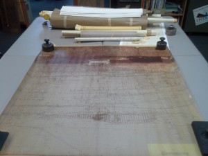
EPCAMR Outreach Specialist, Denise Hernandez, editing mine map image files.
Since Summer 2013, EPCAMR, in collaboration with the Pennsylvania Department of Environmental Protection (PA DEP) Mine Subsidence Insurance (MSI) Program, has processed mine maps under the control of the Office of Surface Mining (OSM) and other private collections. As a result of the work done through this program, mine map information will be available for public use in online and computer systems. The California District Mining Office in Western Pennsylvania is spearheading the mine map processing initiative. More information can be found at here.
The processed information can be used by property owners and developers to make informed decisions on where to locate, build, or buy a home or business. EPCAMR also uses the information for our own purposes in mapping the underground mine pool complexes within the Anthracite Coal Region. In addition, the PA DEP plans to use the processed information to contribute to safe economic practices and prevent/remediate subsidence of land above the mines.
Underground mine map of the Buck Mountain vein.
EPCAMR is the ONLY nonprofit environmental organization in Pennsylvania to receive a 3-year contract for the grant of approximately $340,000. The funding allowed EPCAMR to hire one full-time position and two part-time positions. The GIS Technicians and Specialists have gained experience and become proficient in converting historic mine maps into an archived digital product for public distribution.
In addition to EPCAMR, nine universities across Pennsylvania received grants in this first round of funding. EPCAMR has expertise in the interpretation of underground mine maps and mapping underground coal measures and mine pools. Over the past three years, EPCAMR has scanned 10,000 mine maps, geo-referenced 2,500 mine maps, and digitized 1,000 mine maps from the Wilkes-Barre PA DEP Bureau of Abandoned Mine Reclamation (BAMR), Pottsville District Mining Office, and Earth Conservancy’s Blue Coal Corporation collection.
An interactive website, called the PA Mine Map Atlas, is available to view the maps that EPCAMR and other grantees process. See below.
A companion database, the PA Historic Mine Map Inventory System (PHUMMIS), is also available to search for the maps based on mine name, map collection, company name, county, municipality, and many other attributes.


You must be logged in to post a comment.