


Frank Sindaco grew up and has spent most of his life in the Wilkes-Barre area, and he is excited to join the EPCAMR team. A graduate of G.A.R. High School, Frank previously worked for over 20 years in the non-profit sector as project manager and digital media specialist for human rights organizations. His familiarity with working in poverty-stricken neighborhoods and communities in the region have a great overlap with similar issues EPCAMR faces in the coal region. He grew up in the coalfields of the Wyoming Valley and even played sports on the practice fields full of waste culm in the Heights along Spring Run in the Solomon Creek watershed recently cleanup up by EPCAMR, partners, and the Wyoming Valley Sanitary Authority. He jokingly has said that he thinks he still has some anthracite coal embedded in his knees as a constant reminder of those days. It’s a memory he shares with the Executive Director, Bobby Hughes, who played on the same practice field back in his youth. Frank has worked in the fields with migrant workers, organized with others from the ground up in urban and rural areas dealing with poverty, developed multimedia projects and built online communities with various groups and networks.
Bobby Hughes, EPCAMR Executive Director said, “Frank’s very familiar with the history of NEPA mining impacts and redevelopment, and has worked extensively with ESRI products and data management applications to create a variety of applications and maps for community data. He’s worked with spatial analysis of landscape and social systems, explored network, vector, and raster analysis and data models, and produced cartographic depictions and geovisualizations of qualitative and quantitative data extensively. I believe that he will become invested quickly in our work and become a valuable asset to the EPCAMR Staff. He’ll be thrown into the fire of mosaicking, scanning, geo-referencing, digitizing, and cataloging the thousands of mine maps that remain to be entered into PA’s Historic Underground Mine Mapping Inventory System, but I’m already confident in his ability to hit the ground running since he has been already accustomed to using the ArcGIS Pro software suite and tools that we are already using and his learning curve matches where we are already at with the utilization of the programs and platform.”
He founded the NEPA Organizing Center in downtown Wilkes-Barre in 2008, which helped develop resident leadership through media, social service, and education programs. He returned to school in 2013, received his undergraduate degree in Urban Studies and GIS from Temple University, and recently completed graduate studies in GIS at Johns Hopkins University. Frank’s graduate projects were centered on the development of the PA Community Data Project, which is an open data platform where residents can create, request, and access demographic and quality of life data. Frank is very familiar with the ArcGIS Pro platform, software technology, tools, and extensions that EPCAMR regularly uses on a daily basis in the Mine Mapping Program to scan, digitize, georeference, create mosaics, and catalog our historic mine map collections from the State and private collections.
Frank believes that EPCAMR is at the forefront of environmental GIS work, and he is more than ready to serve NEPA in this new realm. “GIS is a powerful form of connective media that can bring collective data gathering, analysis, and presentation into community hands. I am thankful for the opportunity to build with EPCAMR and contribute to projects that link environmental stability and sustainability to economic development, resident outreach on the awareness of the underground mine mapping and the potential need for mine subsidence insurance, and public policy in the field of abandoned mine land reclamation. The GIS Watershed Outreach Specialist position is an incredible opportunity to collaborate and learn with a great group of Staff from EPCAMR that are leaders in the realm of mine mapping, 3D mapping, and modeling, and assessing and implementing watershed restoration projects in mining-impacted watersheds across Northeastern and Northcentral PA.”
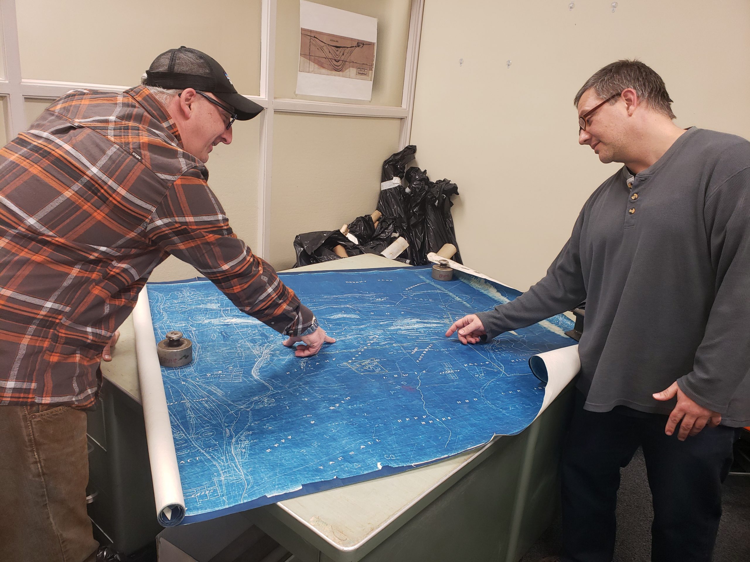
EPCAMR Executive Director, Bobby Hughes showing Frank Sindaco, EPCAMR GIS Watershed Outreach Specialist looks over a blueprint of a map in the Western Middle Coalfields from the Girard Estate Collection.
Frank said, “I have been following EPCAMR’s critical contributions to the development of NEPA communities since the formation of the program over 20 years ago. EPCAMR’s initiatives are incredibly profound and their methods and organizational history reflect public participation and their long term commitment to the growth of the region through the restoration of the mining-impacted watersheds, reclamation of the abandoned mine lands, and the education of the area youth who have participated in hundreds of programs and environmental stewardship projects. EPCAMR projects are essential catalysts that have created new possibilities that bridge environmental stability and sustainability with economic development and public policy.”
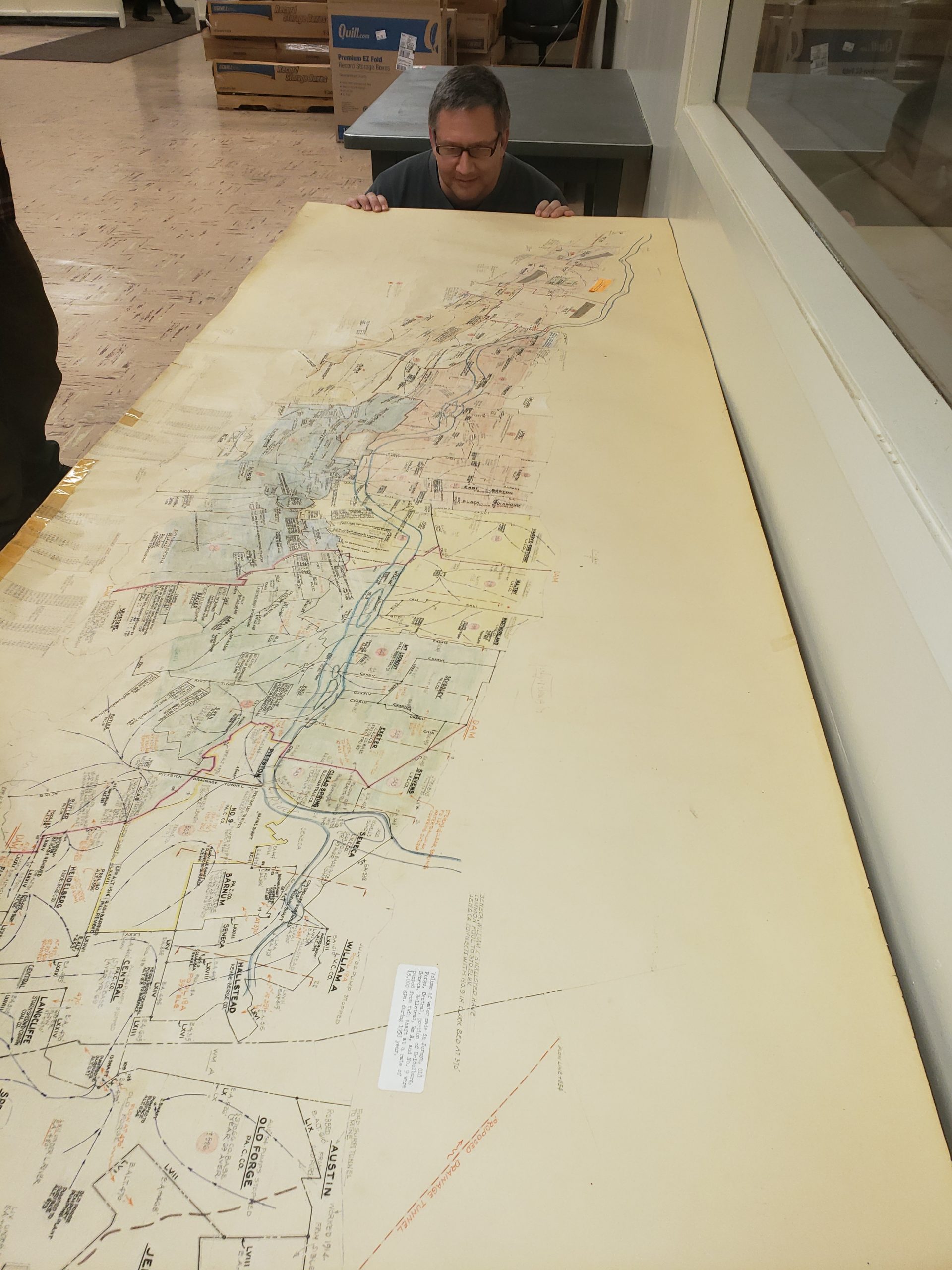
Frank Sindaco, EPCAMR GIS Watershed Outreach Specialist, eyeing up historic mine pools and flow patterns, mine discharges and their elevations, and barrier pillars of the Wyoming Valley on a 1968 Mine Pool Map.
The Mine Subsidence Insurance (MSI) program and project is a vital and fascinating open data project, and the GIS Watershed Outreach Specialist position is an incredible opportunity to collaborate and learn with a great group. “I can’t wait to become an asset to EPCAMR, so that as I can call upon skills and training from a variety of employment, volunteer, and academic experiences. I am fortunate to have worked in nonprofit development in a variety of locations and capacities. I am quite comfortable working collaboratively and communicating between organization, community, and government level stakeholders.”
Frank went on to say, “GIS is a powerful form of connective media, and I would love to develop applications, story maps, and training processes that can bring collective data gathering, analysis, and presentation into the hands of the public throughout the coal regions. I want nothing more than to invest my time and skills to benefit the communities and residents of the EPCAMR Region and want nothing more than to dedicate my efforts and skills to build something meaningful together with the EPCAMR Staff related to the impacts of historic mining throughout PA. That is all that I have ever wanted, to be honest.”
Candidates are already being considered for a second part-time position that is hoped to be filled soon.


You must be logged in to post a comment.