


Just before the Christmas Holidays, EPCAMR received an inquiry from a Mr. Francis Dombrowski, III, Kingston, PA who wanted to know if we would like to obtain a collection of 19 historic mine maps from the Mineral Spring Coal Company, that operated around the area of Parsons, PA. Mr. Dombrowski, III is an avid follower of EPCAMR’s social media posts, enjoys coal mining history, and is a supporter of our work in the region. Of course, we obliged and were excited about having the opportunity to scan them digitally and upload them to the PA Historic Underground Mine Map Inventory System (PHUMMIS) and the PA Mine Map Atlas, let alone be able to receive them as a donation from Mr. Dombroski, III.
Check out this link on the history of Parsons (Parsons History). The first successful coal mining in Parsons was done in 1866, when the Mineral Spring mine was opened. The first breaker was built by the Mineral Spring Coal company. The spring from which Mineral Spring Coal Company takes its name was on the lands of Calvin Parsons. It had gained notoriety for its curative qualities and an effort was made a few years prior to the opening of the coal mines to buy the property, in order to establish an infamous water cure. When the mining commenced in 1866 the source of the spring was tapped, and it was dewatered. The Laurel Run Breaker shortly followed and opened in 1867-68 by the Delaware & Hudson Canal Company. Patch Town histories and where their names were often derived from can be found in this Citizen’s Voice article from August 9th, 2015.

Francis Dombrowksi, III Mineral Springs Mine Map Collection-Parsons, PA donated to EPCAMR
The dates on the maps range from 1905-1952. The Local coal vein names or Formal Names shown are the Skidmore, Red Ash, 3′ Vein, Lower Baltimore Vein, Upper Baltimore Vein, and the Checker Vein. The veins are all located in the Northern Anthracite Coalfield in Luzerne County and the majority of the map types are underground mine maps (12), cross-sections (2), plan map (1), surface maps (3), and a surface topography map (1). The scale on each of the maps are 1″=100′, except for the plan maps for the No. 2 Slope Extension, which is 1″=20′. 2 of the maps are original linens and 17 of the maps are paper copies. The datum is 500′ below tide. The maps were acquired from a Mining Engineer who formerly worked for the Mineral Spring Coal Company.
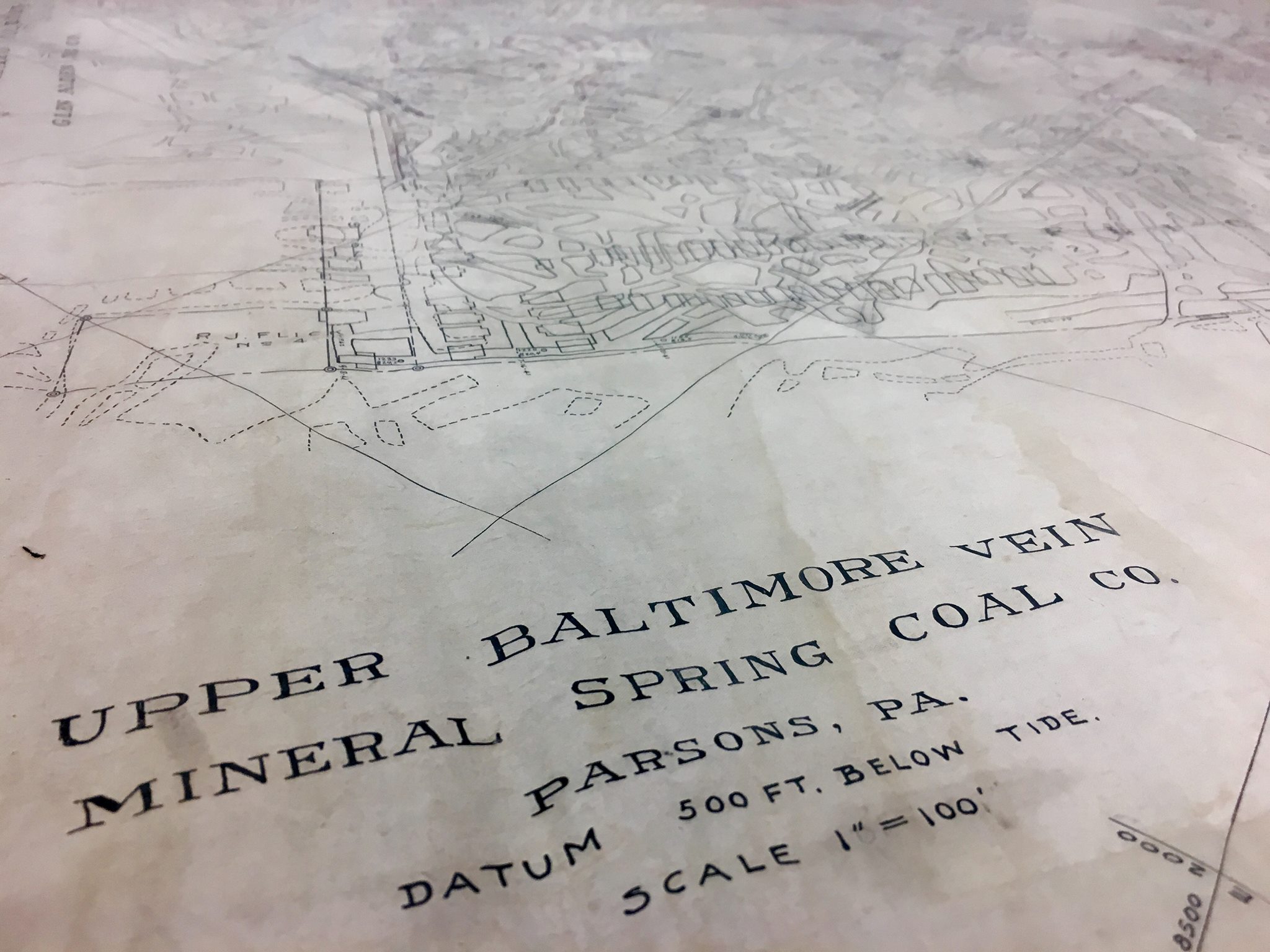
Upper Baltimore Vein Mineral Springs Coal Company-Parson, PA
The maps shows various stages of underground mining development during this period of mining activity. Various barrier pillars are shown. Other adjacent collieries and coal companies are also mapped, along with elevations, historic property owners, culm and silt banks, Water Company lands and reservoirs, slopes, stripping operations, Laurel Run, State Routes 115, Engine houses, haulage roads, old mining roads, borehole locations, mined out areas, section lines, cross sections, and rock tunnels, drainage tunnels and single, double, and even triple compartment mine shafts. It is truly amazing what one can find on these historic mining maps, once they know what they are looking for. EPCAMR has developed a mine map symbology PDF key to assist the public with identifying many of these mining features above.
EPCAMR has given the distinction of naming this collection of mining maps the Francis Dombrowski, III Mineral Springs Mine Map Collection for archival purposes. It took 22 GB of storage to create the collection digitally to be properly archived at EPCAMR. EPCAMR Executive Director, Robert E. Hughes, stated, “We would like to thank and acknowledge Mr. Dombrowski, III for reaching out to EPCAMR and for seeing the value in the preservation and archival purposes of them for the future. EPCAMR is going to use them to update our regional underground mine pool models and to assist in identifying probable locations for mine subsidence. The maps also allow us to determine where surface water from our mountain streams, like Laurel Run and its’ tributaries are being lost to the underground mine workings where from the looks of many of the maps that were reviewed in this collection, have been mined out completely. We also want to make people aware of the PA Mine Subsidence Insurance Program and the benefits that obtaining coverage can offer to residents, particularly, in the Coal Region, and more importantly, in this case, in the Parsons area of the City of Wilkes-Barre and Plains Township.”
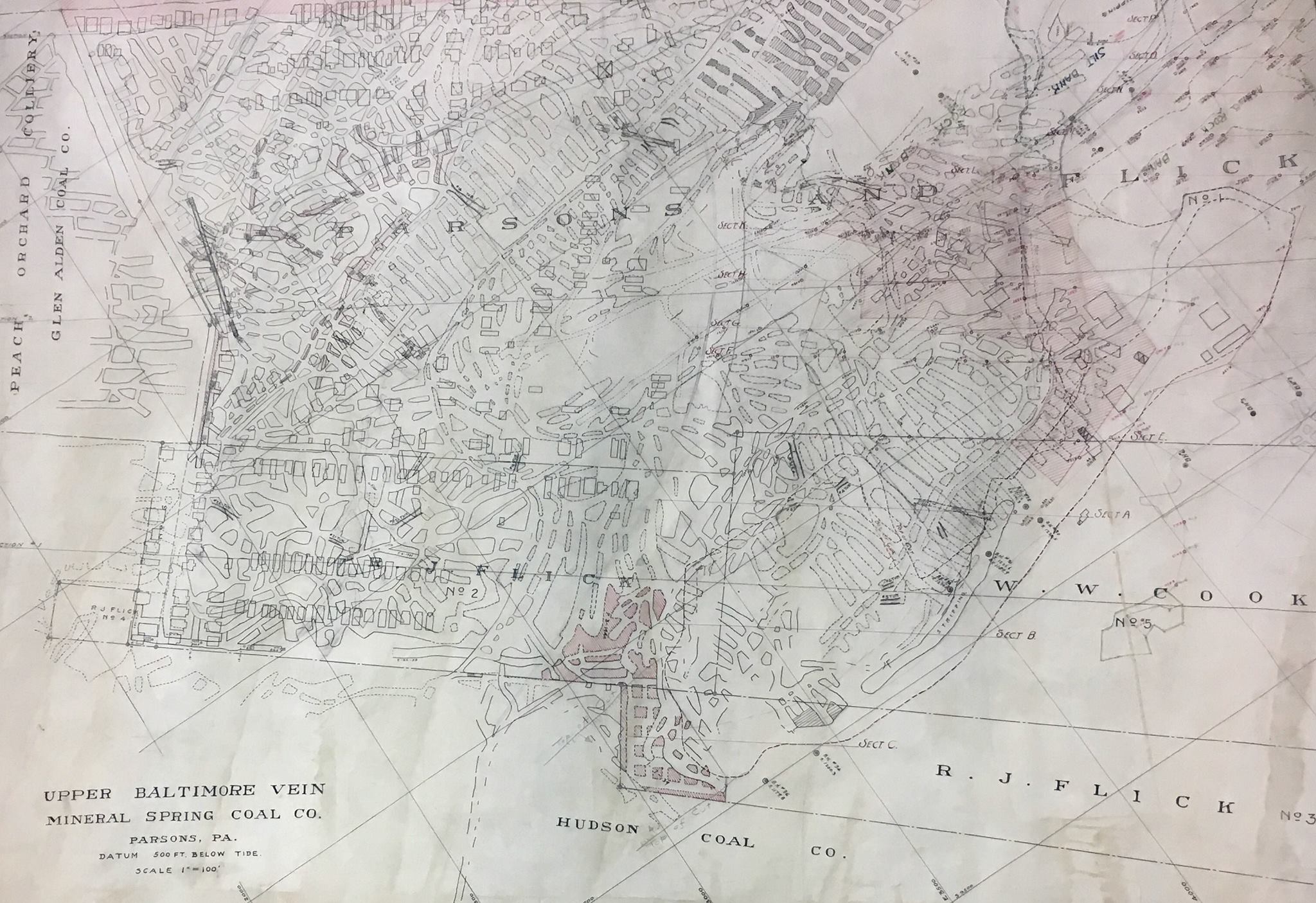
Mine Map showing various stages of mining advancement


You must be logged in to post a comment.