


Samantha Schafer, Emmaus, PA, a Spring 2012 graduate of Bloomsburg University, PA with a Bachelor of Science in Geology has joined the EPCAMR Staff on a part-time basis as a GIS Technician under our Mine Subsidence Insurance Grant.
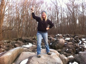
Samantha Schafer at “Ringing Rock” State Park, outside of Allentown, PA. Ringing Rocks Park is a 128 acre State Park nestled in the woods in Upper Black Eddy. Located within the park is a field of boulders, about 7-8 acres in size, that have an unusual property. When the rocks are struck with a hammer or another rock, they sound as if they are metal and hollow and ring with a sound similar to a metal pipe being struck.
Since Fall 2013, the EPCAMR Staff have been working to scan underground mine maps as part of the PA Department of Environmental Protection Mine Subsidence Insurance Program (PA DEP MSI). The 3 year project, which awarded EPCAMR approximately $340,000 in funding to process maps owned or controlled by the Commonwealth of PA, U.S. Office of Surface Mining (OSM) or from private collections, will aid the public in determining whether or not it is necessary to purchase Mine Subsidence Insurance. The scanned maps will include information about the four Anthracite coal fields, with some of Earth Conservancy’s maps from their Blue Coal collection also being scanned. EPCAMR was the only regional non-profit to receive funding due to our expertise and knowledge of the Anthracite region. All other funding was awarded to universities and colleges. By the end of the project, EPCAMR will complete a total of 8000 maps, with 2000 from DEP’s Pottsville Bureau of Deep Mine Safety (DMS), 5000 DEP Wilkes-Barre Bureau of Abandoned Mine Reclamation (BAMR), 1000 maps from Earth Conservancy’s Blue Coal collection, unless some of the map numbers are reallocated due to underestimates within the State’s collections. In addition, EPCAMR will georeference 1000 maps from Pottsville District Mining Office (DMO) and 500 maps from Earth Conservancy’s Blue Coal, while digitizing 300 maps from Pottsville DMO, 500 maps from Wilkes-Barre BAMR, and 200 maps from Earth Conservancy’s Blue Coal. The total catalog of scanned maps will include 2000 maps from DEP’s Wilkes-Barre BAMR and 5000 mine images from DEP’s Mine Image Inventory.
The maps, which come in a variety of materials such as Mylar, Sepia, etc., are usually very wide and long, making them difficult to process using normal scanners. In order to mediate this issue, EPCAMR purchased two 56′ Color Trac Scanners in order to make the maps accessible by computer. Once the maps are scanned, they are uploaded into a system called PHUMMIS, which stands for Pennsylvania Historic Underground Mine Map Inventory System, where they are cropped and aligned. After this the images, which enter PHUMMIS as tagged image files, or TIF files, are converted to seamless image database files, or SID files. Converting the images to SID files allows for them to be compressed 20x smaller than their original size, making it easier for the files to be uploaded over the internet and used in other software programs, such as ArcGIS.
After the map files are converted, with the help of Michael Hewitt, EPCAMR Project Manager and Robert E. Hughes, EPCAMR Executive Director, Staff will georeference the maps in order to align them with base maps and aerial photos. Georeferencing is a crucial part of the process because it ensures the greatest amount of accuracy for aligning the map with the actual land. Many of the maps are very old and hand-drawn, meaning that the map alone cannot serve as an accurate picture of where the mines are located. After the maps are georeferenced, Mike uploads the images and lines up the maps in order to look for specific features such as mine entrances, shaft length, depth, coverage area, and mine shaft elevation. Determining these features allows for development of an accurate model of the underground mines. After features are determined, the plotted images are uploaded into geodatabase, the common spatial data storage and management framework for ArcGIS. If the elevation of the mine shaft can be determined, then a 3-D digital model of the mine can be produced.
Samantha has previous experience using GIS and field geophysical equipment which will come in handy right away on the job. She is a team player and very self-motivated. She is a member of several Geology Professional Affiliations, such as the Geological Society of America, American Association of Petroleum Geologists, and was a member of the Pittsburgh Geological Society earlier in her collegiate career. She spent time studying geology in Colorado, Utah, and Wyoming with SUNY Buffalo taking a geological field course and camp. Her Senior research consisted of geologically mapping an area north of Bloomsburg, PA to further understand the folding associated with the Appalachian Mountains in the Fishing Creek Watershed and is already familiar with the “Whaleback” Geologic feature in Bear Valley, in the Shamokin Creek Watershed down in the Western Middle Anthracite Coalfields. Samantha stated, “Geology has been a very exciting and rewarding topic to study for me. It encompasses my love of nature, geologic landscapes, and the outdoors. Hiking, kayaking, and climbing are more enjoyable with the knowledge of the environment in which I play and now get to work in, especially having an opportunity to understand and gain experience in the coalfields of Northeastern PA with one of the premier state-wide environmental organizations across PA working on abandoned mine reclamation, watershed restoration, underground mine mapping, and outdoor environmental education.”
She has worked at Whitewater Challengers as a River Guide for eight years on the Lehigh River where she utilized her hydrology expertise to guide up to 120 guests down river and coordinate whitewater trips. While she was in College at Slippery Rock University, she organized and led trips for rock climbing, whitewater kayaking, and canoe trips and became a certified belayer at the indoor climbing wall for Slippery Rock University Outdoor Adventure, where she was an Outdoor Adventure Specialist.
She exclaimed, “I am very excited to join the team here at EPCAMR. This is an amazing opportunity to gain experience as a GIS Technician. I expect to learn a lot about the Coal Region that I call home. It’s going to be very rewarding to be able to learn about the surface abandoned mines and underground coal mining hydrogeology and structural geology that will increase my knowledge of the Coal Region. This is a huge undertaking by EPCAMR, but from what I’ve heard and seen about their quality of work, level of expertise and professionalism from others, I’m confident that this position will suit me well and help to advance my career in the future.”
Robert stated, “I’m very happy to bring on board yet another “rock hound” like myself who I think will bring her goal oriented, determined, and productive attitude to the work that EPCAMR is currently going full steam ahead on. She will be a nice compliment to our existing team and will get started scanning right away on the mine map collections as well as some initial training on interpreting and reading Anthracite Mine Maps, both from the surface perspective, and the underground mining perspective. It’s sure to give her a whole new level of understanding of the work that EPCAMR has been doing in the Coal Region for the last 20 years.”


You must be logged in to post a comment.