


Since fall 2013, GIS technicians Kelsey Biondo and Bridgette Robinson have been working with EPCAMR to scan underground mine maps as part of the PA Department of Environmental Protection Mine Subsidence Insurance Program (PA DEP MSI). The 3 year project, which awarded EPCAMR approximately $340,000 in funding to process maps owned or controlled by the Commonwealth of PA, U.S. Office of Surface Mining (OSM) or from private collections, will aid the public in determining whether or not it is necessary to purchase Mine Subsidence Insurance. The scanned maps will include information about the four Anthracite coal fields, with some of Earth Conservancy’s maps from their Blue Coal collection also being scanned. EPCAMR was the only regional non-profit to receive funding due to our expertise and knowledge of the Anthracite region. All other funding was awarded to universities and colleges. By the end of the project. EPCAMR will have completed a total of 8000 maps, with 2000 from DEP’s Pottsville Bureau of Deep Mine Safety (DMS), 5000 DEP Wilkes-Barre Bureau of Abandoned Mine Reclamation (BAMR), 1000 maps from Earth Conservancy’s Blue Coal collection. In addition, EPCAMR will georeference 1000 maps from Pottsville District Mining Office (DMO) and 500 maps from Earth Conservancy’s Blue Coal, while digitizing 300 maps from Pottsville DMO, 500 maps from Wilkes-Barre BAMR, and 200 maps from Earth Conservancy’s Blue Coal. The total catalog of scanned maps will include 2000 maps from DEP’s Wilkes-Barre BAMR and 5000 mine images from DEP’s Mine Image Inventory.
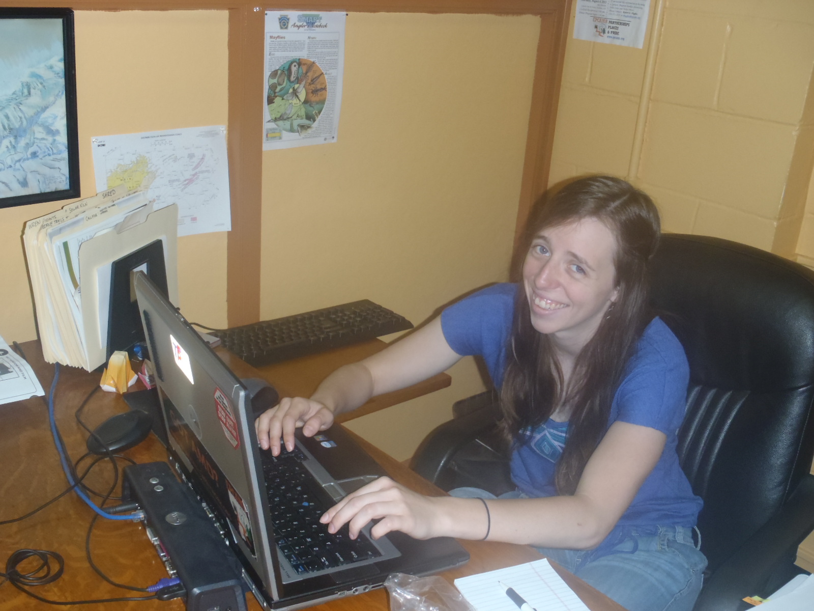
Kelsey Biondo, EPCAMR GIS Technician, examines scanned maps on her laptop.
Kelsey Biondo, who started as a Watershed Outreach Intern with EPCAMR in 2012, and Bridgette Robinson, who joined EPCAMR in Fall 2013, have since become valued GIS technicians and part time employee working on the PA DEP MSI Project. The maps, which come in a variety of materials such as Mylar, Sepia, etc., are usually very wide and long, making them difficult to process using normal scanners. In order to mediate this issue, EPCAMR purchased two 56′ Color Trac Scanners in order to make the maps accessible by computer. Once the maps are scanned, they are uploaded into a system called PHUMMIS, which stands for Pennsylvania Historic Underground Mine Map Inventory System, where they are cropped and aligned. After this the images, which enter PHUMMIS as tagged image files, or TIF files, are converted to seamless image database files, or SID files. Converting the images to SID files allows for them to be compressed 20x smaller than their original size, making it easier for the files to be uploaded over the internet and used in other software programs, such as ArcGIS.

Bridgette Robinson, EPCAMR GIS Technician, stand with her beloved 56′ ColorTrac Scanner.
After the map files are converted, Bridgette and Kelsey, with the help of Michael Hewitt, EPCAMR Project Manager, georeference the maps in order to align them with base maps and aerial photos. Georeferencing is a crucial part of the process because it ensures the greatest amount of accuracy for aligning the map with the actual land. Many of the maps are very old and hand-drawn, meaning that the map alone cannot serve as an accurate picture of where the mines are located. After the maps are georeferenced, Mike uploads the images and lines up the maps in order to look for specific features such as mine entrances, shaft length, depth, coverage area, and mine shaft elevation. Determining these features allows for development of an accurate model of the underground mines. After features are determined, the plotted images are uploaded into geodatabase, the common spatial data storage and management framework for ArcGIS. If the elevation of the mine shaft can be determined, then a 3-D digital model of the mine can be produced.

Michael Hewitt-EPCAMR Project Manager, Robert Hughes- EPCAMR Executive Director, John Welsh- Philadephia Photographer, Alana Mauger- Philadelphia journalist, David Svab- EPCAMR Intern, and Bill Best- President of Membership for the Huber Breaker Preservation Society, examine an underground mine map.
“The project’s main goal is to scan and upload cropped and plotted maps to the internet so that public users will have easy access to information about mining in this area. Although many of the visible signs of coal mining, such as collieries, breakers, and entrances to mine shafts, have disappeared from this area, the vast majority of the mines remain, leaving a massive web of coal veins beneath the region’s cities and homes. By processing these underground maps, EPCAMR, in collaboration with the PA DEP, will be able to provide current home owners and business owners with the knowledge they need to secure Mine Subsidence Insurance. In addition, making this information available will help inform prospective home and business owners about what’s located under the area they are planning on purchasing or building a house or office,” explained EPCAMR Executive Director, Robert Hughes. “You’d be surprised at how many people in the region do not have Mine Subsidence Insurance and should!,” exclaimed Robert Hughes. If you have any additional maps from private collections, EPCAMR is looking for them to be scanned and added to the PHUMMIS digital catalog. Contact rhughes@epcamr.org to donate maps!

This mine map measures 4.5×13 ft and that’s not even the largest EPCAMR has scanned!


You must be logged in to post a comment.